Carrillo Airport
Appearance
Carrillo Airport Playa Sámara/Carrillo Airport | |||||||||||
|---|---|---|---|---|---|---|---|---|---|---|---|
| Summary | |||||||||||
| Airport type | Public/Private | ||||||||||
| Operator | DGAC | ||||||||||
| Serves | Puerto Carrillo, Costa Rica | ||||||||||
| Elevation AMSL | 50 ft / 15 m | ||||||||||
| Coordinates | 9°52′15″N 85°28′50″W / 9.87083°N 85.48056°W | ||||||||||
| Map | |||||||||||
 | |||||||||||
| Runways | |||||||||||
| |||||||||||
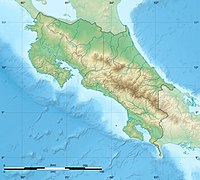
Carrillo Airport (IATA: PLD, ICAO: MRCR) is an airport serving Puerto Carrillo, a Pacific coastal village in Guanacaste Province, Costa Rica. The airport and village are 5 kilometres (3 mi) east of Sámara village.
Facilities
The airport has a grass landing strip and a covered shelter that is occasionally used to weigh luggage before boarding. There are no amenities nearby. As of 2024, the airport has not been in use for several years and remains closed.
See also
References
- ^ "Airline and Airport Code Search". IATA. Retrieved 8 April 2016.
- ^ "AIP Costa Rica: Part 3 Aerodromes" (PDF). Dirección General de Aviación Civil. 22 October 2009. Archived from the original (PDF) on 27 September 2011. Retrieved 28 September 2011.
- ^ "Carrillo Airport". SkyVector. Retrieved 20 March 2019.
External links
- Airport information for Carrillo Airport at Great Circle Mapper.
- Accident history for Playa Samara Airport at Aviation Safety Network
- "Carrillo (Samara) Domestic Airport". GoVisitCostaRica.com.

